
Geospatial Consultancy Services PowerPoint PPT Presentations
All Time
Recommended

... (WFS) http://100.200.128.70/geoserver/wfs?request=GetFeature&version=1.0.0&typeName=massgis: ...
| PowerPoint PPT presentation | free to download

The Remote Sensing Services market is projected to grow from USD 13.2 billion in 2022 to USD 26.6 billion by 2027, at a CAGR of 14.9%.
| PowerPoint PPT presentation | free to download

Geospatial Data Tools and Services for Academic Library Users: the Mann Library Experience Gail Steinhart Environmental Sciences and GIS Librarian
| PowerPoint PPT presentation | free to download

... given the task of taking the lead in the development of an integrated ... 'Eforms for E-Gov' Pilot Rick Rogers, Fenestra, Team Lead. Education/Analysts: ...
| PowerPoint PPT presentation | free to view

Preserving State and Local Agency Digital Geospatial Data NC Geospatial Data Archiving Project NCGDA
| PowerPoint PPT presentation | free to download

Wide range of outreach/collaboration: FGDC, ESRI, EDINA (JISC), USGS, OGC, TRB, etc. Pilot project, georegistering digital archival geologic maps ...
| PowerPoint PPT presentation | free to download

TBRC global geospatial analytics market report includes solutions, services, surface and field analytics, geovisualization.
| PowerPoint PPT presentation | free to download

... The EAM Program Consolidate Integrate Leverage Consolidate Biting the ... Oracle en DB2) Software that ... Overview http://geodiensten.alliander.local ...
| PowerPoint PPT presentation | free to download
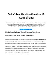
Confused by Raw Data? Let Us Transform It into Meaningful Insights! Make better business decisions with our Data Visualization Services. We create interactive dashboards, reports, and engaging visual stories from complex data. Get a free consultation today! Let’s Connect – +1 (347) 9739732, or mail us at inquiry@digiprima.com
| PowerPoint PPT presentation | free to download

Geospatial solutions collect, manage, organize, and store data pertaining to geographic information such as zip codes, addresses, or latitudinal and longitudinal coordinates to a location. This includes data accumulated by satellites, digital and analog maps, and street and aerial imagery. Some instances of geospatial solution technologies include Global Positioning Systems (GPS), Geographic Information Systems (GIS), imagery analysis, and remote sensing.
| PowerPoint PPT presentation | free to download
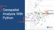
Do you want to make a career in geospatial technology? What knowledge do you have about the field and its connection with Python, the programming language? At GAH, we provide various geospatial courses to educate aspiring candidates. If you are interested to learn about Geospatial Analysis with Python, here’s a presentation that will give you a brief idea about the topic.
| PowerPoint PPT presentation | free to download

Marvel Geospatial - a solution for accurate data mapping and management. We at Marvel Geospatial, provide Geospatial Solution with accurate data mapping and management. Our service includes GIS, BIM and LiDAR mounted UAVs. We at Marvel Geospatial, provide you with an ultimate Geospatial Solution with our accurate data mapping and management services. Marvel brings horizontal and vertical integration of Satellite/Aerial Remote Sensing, Positioning Applications, Photogrammetry, GIS Databases and Applications, GIS Web-services and Networking of GIS Databases.Marvel offers expert advice and reliable data for all geospatial needs. Discover what’s possible with Marvel. Give us a call today for a free consultation!
| PowerPoint PPT presentation | free to download

Joomla Bird couples your organization and business with a flexible model supported by the Content Management System (CMS) expertise. Having vast experience in the related functional areas, with Joomla Bird you fly high. Our services help you ascertain and foretell the essentials for the ever growing business. Tags: #JoomlaUpgrade, #JoomlaMigration, #MobileWebDesign, #EcommerceSolution, #TemplateDesign, #WebDevelopment, #Website Designing, # Websitedesignanddevelopment, #E-commercewebsitedevelopment, #E-commercewebdesign
| PowerPoint PPT presentation | free to download

According to a new report Global Geospatial Analytics Market (2016-2022), published by KBV Research, the global Geospatial Analytics Market is expected to attain a market size of $79.8 billion by 2022, growing at a CAGR of 18.0% during the forecast period. FULL REPORT: https://kbvresearch.com/news/global-geospatial-analytics-market/
| PowerPoint PPT presentation | free to download

Global geospatial solutions market size is expected to reach $1009.56 Bn by 2028 at a rate of 15.9%, segmented as by solution type, hardware, software, service
| PowerPoint PPT presentation | free to download

Witness the largest gathering of the international geospatial community which culminates the value and power of GIS technology. Visit: http://www.aflexgis.com/aflexgis/ .
| PowerPoint PPT presentation | free to download

The Remote Sensing Services market is projected to grow from USD 13.2 billion in 2022 to USD 26.6 billion by 2027, at a CAGR of 14.9%.
| PowerPoint PPT presentation | free to download

... finalizing support documents (biosketches, letters of support from consultants ... sample design data collection. data manipulation data validation ...
| PowerPoint PPT presentation | free to view

According to the latest research report by IMARC Group, The United States geospatial analytics market size is projected to exhibit a growth rate (CAGR) of 10.14% during 2024-2032. More Info:- https://www.imarcgroup.com/united-states-geospatial-analytics-market
| PowerPoint PPT presentation | free to download

Global Geospatial Solutions market Size, Share, Trends, Growth, Opportunities and Industry Analysis by Energy, Power and Mining | WHIPSMARTMI
| PowerPoint PPT presentation | free to download
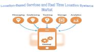
The report segments the LBS and RTLS market comprehensively and provides the closest approximations of the revenue numbers for the overall market & the subsegments. The market numbers are further split across the different verticals and regions.
| PowerPoint PPT presentation | free to download

How much does the government spend every year on geotechnology? ... Top ten vendors account for 70% of dollar-value of all geotechnology contracts ...
| PowerPoint PPT presentation | free to view
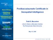
Postbaccalaureate Certificate in Geospatial Intelligence Todd S. Bacastow John A. Dutton e-Education Institute The Pennsylvania State University
| PowerPoint PPT presentation | free to download

The Global Geospatial Analytics Market is expected to attain a market size of $79.8 billion by 2022, growing at a CAGR of 18.0% during the forecast period. Full report - https://kbvresearch.com/global-geospatial-analytics-market/
| PowerPoint PPT presentation | free to download

TBRC global electrical safety personal protective equipment report includes head protection, eye and face protection, electrical, automotive... @ @ https://bit.ly/3FFVkJa
| PowerPoint PPT presentation | free to download

The global geospatial solutions market size is expected to grow from $378.45 billion in 2021 to $444.32 billion in 2022 at a compound annual growth rate (CAGR) of 17.4%.
| PowerPoint PPT presentation | free to download

Rising use of AI and ML in geospatial analytics, increasing number of government projects, and rapid urbanization are some key factors driving market revenue growth
| PowerPoint PPT presentation | free to download

Global Geospatial Market is expected to grow significantly as Geospatial Market has been valued at USD 75 billion by 2022 growing with 16.6% of CAGR during forecast period 2016 to 2022
| PowerPoint PPT presentation | free to download

TBRC global satellite data services market report includes administrative, commercial, scientific, energy and power, defense and intelligence, engineering and infrastructure https://bit.ly/3Rtmjft
| PowerPoint PPT presentation | free to download

... performance, user-friendly interface for viewing and chipping streamed imagery. ... Save a chip' as a compliant NITF or GeoTIFF image at user-specified resolution ...
| PowerPoint PPT presentation | free to view

Global geospatial analytics market research report defines & describe, and forecast the global geospatial analytics market on the basis type, technology, application, by end-user and geography.Get full report details at https://www.inkwoodresearch.com/reports/geospatial-analytics-market-forecast-2017-2024 Or email us at sales@inkwoodresearch.com
| PowerPoint PPT presentation | free to download
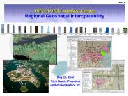
MWCOG GIS Committee Meeting Regional Geospatial Interoperability
| PowerPoint PPT presentation | free to download

Big Data. New Physics. And Why Geospatial Data is Analytic SuperFood Jeff Jonas, IBM Distinguished Engineer Chief Scientist, IBM Entity Analytics
| PowerPoint PPT presentation | free to download

7 Community Colleges and 4 Universities. National in scope ... Online education (both credit and noncredit). Advocate for financial resources ...
| PowerPoint PPT presentation | free to view

Reverse Lookup search by telephone number. U.S. All search all directories at once ... Qsent's iQ411 Interactive: Reverse 911 Alert Lookup. 21 ...
| PowerPoint PPT presentation | free to view

Baghdad, Iraq. September 10, 2002. GeoConnections Secretariat. Old ways don't ... National Atlas on-line mapping of Canadian issues. 200,000 dynamic maps/month ...
| PowerPoint PPT presentation | free to view

Severe weather reports, live watches/warnings. Radar, satellite, model grids... Serve Society's Needs for Weather and Water Information. NRC report: ...
| PowerPoint PPT presentation | free to view

... desires: understanding the world around us and our place in it' ... GIS Map Production Guidelines. Global Navigation Satellite Systems. Tangible Outputs ...
| PowerPoint PPT presentation | free to view

Toward an enterprise information system for the Nation ... Dover, DE or West Trenton, NJ. Urbana, IL. Nashville, TN or Charleston, WV. Indianapolis, IN ...
| PowerPoint PPT presentation | free to view

... and Registries', ListServ Discussion Summary, Joe Chiusano, Booz Allen Hamilton. ... 45 a.m. Joseph Chiusano, Booz Allen Hamilton: Web Services Security and More: ...
| PowerPoint PPT presentation | free to view

The Team: Debra Forman, John Graves, Brand Niemann (technical consultant), and Brian Trulear ... 5.1 Clarify the work flow process. 5.2. ...
| PowerPoint PPT presentation | free to view

... band selection (just default greyscale or false colour) No ... default browse maps e.g. greyscale (SAR), false colour (optical), pseudo-colour (geophysical) ...
| PowerPoint PPT presentation | free to view

... Malaysia (DSM) and Standard and Industrial Research Institute of Malaysia (SIRIM) ... xi. Public Work Department. xii. Malaysian Centre For Remote Sensing. xiii. ...
| PowerPoint PPT presentation | free to view

The key to the ultimate success of Web services, but has some key limitations, ... UDDI Business Registry (UBR) 'White Pages' (general information about a ...
| PowerPoint PPT presentation | free to view

How does SIDS fit into the broader Spatial Data Infrastructure and Information ... Web Mapping Service (WMS) via OGC Landmap Viewer or OGC Compliant softwares ...
| PowerPoint PPT presentation | free to view

NDIIPP Project Update NC Geospatial Data Archiving Project NCGDAP North Carolina State University Li
| PowerPoint PPT presentation | free to download

Identification, Selection, and Appraisal within the North Carolina Geospatial ... County, City, COG Vector Data. Variable mix of layers; some continuous update ...
| PowerPoint PPT presentation | free to view

Theresa Pardo, Deputy Director, Center for Technology in Government, University of Albany ... Reference Model for an Open Archival Information System (OAIS) ...
| PowerPoint PPT presentation | free to view

gml:name Lithology log /gml:name xmml:categoryList property='#lith' codeSpace='#unitcodes' ... http://my.big.org/classifications/lithology/komatiite ...
| PowerPoint PPT presentation | free to view

Points of Engagement with Spatial Data Infrastructure and Industry ... Data Sharing Agreements as the 'blanket', individual agreements as the 'quilt' ...
| PowerPoint PPT presentation | free to download

The African Internet Exchange System (AXIS) 2 for SPACE SCIENCE ... Web site: WWW.african-union.org and/or WWW.Africa-eu-partnership.org ...
| PowerPoint PPT presentation | free to view

Guidelines for Procurement of Professional Aerial Imagery, Photogrammetry, Lidar and Related Remote Sensor Based Geospatial Mapping Services Developed by
| PowerPoint PPT presentation | free to download

22 downloadable GIS data layers. 3 OGC WMS services (web services) 10 web mapping ... Tax Dept. Photos. Street View Images. Other Data Types Place-based Data ...
| PowerPoint PPT presentation | free to download

Conduct and sponsor research for GI Science. Support GIS applications and services ... Incentive Based Partnerships. A Tapestry of Base Content ...
| PowerPoint PPT presentation | free to view

Guidelines for Procurement of Professional Aerial Imagery, Photogrammetry, Lidar and Related Remote Sensor Based Geospatial Mapping Services Developed by
| PowerPoint PPT presentation | free to download

The global geospatial imagery analytics market size is projected to reach USD 16 billion by 2025.
| PowerPoint PPT presentation | free to download