Eosdis PowerPoint PPT Presentations
All Time
Recommended
A production capability for standard science data products from EOS instruments ... Data Center, Langley, VA, and National Snow and Ice Data Center, Boulder, CO) ...
| PowerPoint PPT presentation | free to download
NASA's Earth Observing System Data and Information System provides ... Sea Surface Temperature, Ocean Winds, Circulation and Currents, Topography and Gravity ...
| PowerPoint PPT presentation | free to download
Title: No Slide Title Author: jws Last modified by: Kevin Howald Created Date: 7/8/1998 4:12:15 PM Document presentation format: On-screen Show Other titles
| PowerPoint PPT presentation | free to download
hdfeos.org
| PowerPoint PPT presentation | free to download
Use free MrSID Software Development Toolkit (SDK) to enable existing ... Aerial/Satellite Imagery. Geographic Information Systems. Document Management Systems ...
| PowerPoint PPT presentation | free to download
Siri Jodha Singh Khalsa. khalsa@colorado.edu. SJSK 2. HDF-EOS Workshop II. Topics ... Metadata is information that identifies and characterizes an information product. ...
| PowerPoint PPT presentation | free to download
a Z 39.50 problem (Z 39.50 is a FAP). This is a operations problem ... e.g. Berkeley weekly Landsat images since 1972. = 1000 tape accesses. ...
| PowerPoint PPT presentation | free to download
Launch of Aura (July 25) marks end of development phase of ... Calypso. Over 3 petabytes of EOSDIS archived data. NATIONAL AERONAUTICS. AND SPACE ADMINISTRATION ...
| PowerPoint PPT presentation | free to download
EOSDIS is a system to acquire, archive, manage and distribute NASA's Earth observation data. ... EOSDIS consists of the geographically distributed EOSDIS Core ...
| PowerPoint PPT presentation | free to download
... advanced information technology and communications capabilities should ... of Earth system data should work together to share their digital information ...
| PowerPoint PPT presentation | free to view
Next generation NASA Earth Science Data and Information Systems. ... solicitation adding needed activities in research, education and applied science. ...
| PowerPoint PPT presentation | free to download
We now have the entire Path for the Product, but we want data only for Madagascar ... Recall we got the Paths & Coordinates for Madagascar from Terra Orbit Paths ...
| PowerPoint PPT presentation | free to view
EOSDIS provides support for high data volumes from Aqua, Terra, and Landsat 7, ... Distinct users includes users accessing DAAC web pages, including web-crawlers ...
| PowerPoint PPT presentation | free to download
July 1, 2001 launch date (depends on rocket) 600 km orbit @ 94 degree inclination. ... EOSDIS - http://spsosun.gsfc.nasa.gov/New_EOSDIS.html ...
| PowerPoint PPT presentation | free to view
EOSDIS Data Centers are co-located with science facilities, educational ... Guidance for Science Data Centers through Understanding Metrics ...
| PowerPoint PPT presentation | free to view
Presentation at the Applied Information Sciences Research ... Volcanology. Ecosystem Dynamics. O3. precursor gases. ICESat (1/03) Ice Topography. And Altimetry ...
| PowerPoint PPT presentation | free to view
Title: GENESIS: A Science Information System for the Study of Global Change Author: T Yunck Last modified by: Thomas Yunck Created Date: 9/10/1997 9:00:16 AM
| PowerPoint PPT presentation | free to view
Interoperability Among EOS Data Gateway, ECHO and CEOS INFEO Systems CEOS WGISS Subgroup Meeting May 9, 2002 Frascati Italy Chao-Hsi Chang NASA/EDG
| PowerPoint PPT presentation | free to view
Located at USGS EROS. ... Land Processes Distributed Active Archive (LP DAAC) at EROS ... (SGT contractor to USGS/EROS, LP DAAC Scientist, vice-chair) ...
| PowerPoint PPT presentation | free to download
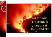
FOREST FIRE REPORTING in Uttarakhand - Use of RS & GIS Forest Fire in Chir pine Forests Comparison of Forest Cover Map , Forest Type Map and Forest Fire Maps There is ...
| PowerPoint PPT presentation | free to download
asterweb.jpl.nasa.gov
| PowerPoint PPT presentation | free to view
MODIS Science Team Meeting Paula S. Bontempi MODIS Program Scientist Earth-Sun System Division Science Mission Directorate National Aeronautics and Space Administration
| PowerPoint PPT presentation | free to download
1. HDF-EOS Workshop II. HDF-EOS Workshop II Introduction. Candace Carlisle ... Candace Carlisle, NASA. Dan Marinelli, NASA. John Berbert, NASA. Doug Ilg, RITSS ...
| PowerPoint PPT presentation | free to download
HDF-EOS defines standard 'profiles' for the use of HDF ... Transverse Mercator. Universal Transverse Mercator. Hotine Oblique Mercator. Space Oblique Mercator ...
| PowerPoint PPT presentation | free to download
CW Phase II Timeline - Overview The following s are a top-level look at the timeline for key Coherent Web Phase II projects. Additional development and ...
| PowerPoint PPT presentation | free to view
MODIS Land Science Team Meeting March 24, 2005. Trends in MODIS Land Product ... dwyer@usgs.gov. Marilyn Kaminski. NSIDC DAAC. marilynk@nsidc.org. Outline ...
| PowerPoint PPT presentation | free to download
HDF Resources for EOS Users Carol.L.Boquist@nasa.gov Background - As a result of last years HDF Workshop, titled How Can We Help You?, the HDF Group joined the ...
| PowerPoint PPT presentation | free to download
GeoBrain A Presentation to the SEEDS Technology Infusion Working Group of the NASA funded project: NASA EOS Higher-Education Alliance: Mobilization of NASA EOS Data ...
| PowerPoint PPT presentation | free to view
While not really an advisory committee, the research community plays a critical ... to data life cycle, including, but not only, archive and preservation issues ...
| PowerPoint PPT presentation | free to view
Title: PowerPoint Presentation Author: Dr. Mark Matties Last modified by: Dr. Mark Matties Created Date: 7/17/2002 3:27:31 PM Document presentation format
| PowerPoint PPT presentation | free to view
Title: PowerPoint Presentation - SNGSM WBS Subject: Updated December 2005 Author: Vir Thanvi Last modified by: Office 2004 Test Drive User Created Date
| PowerPoint PPT presentation | free to download
Current Plans for Long Term Archiving of MODIS Data MODIS Meeting November 2, 2006 University of Maryland University College Martha Maiden Program Executive Earth ...
| PowerPoint PPT presentation | free to download
Many data producers have very tiny budgets. Basic Design Goals ... Custom 'flat file' JDBC 'New' Features. Animation. Coastline and political boundary overlays ...
| PowerPoint PPT presentation | free to download
Lianhong Gu, Dennis Boldocchi, University of California at Berkeley ... Deciduous Forests. Conifers forests. Crops and Grassland. Harvard Forest 1995 -0.633 ...
| PowerPoint PPT presentation | free to view
Many new and existing users might benefit greatly from having a roadmap to ... A command line C program for viewing the contents of an HDF-EOS5 file, and ...
| PowerPoint PPT presentation | free to download
Supplementary L1B data and L1B browse production. ASTER Data Flow. TERRA Satellite ... available from the LP DAAC will have associated 700 x 830 pixel browse images. ...
| PowerPoint PPT presentation | free to view
Accessing NASA data
| PowerPoint PPT presentation | free to download
archived geo-object. user geo-object. Intermediate geo-object. no service. data service ... Rapid modeling and analysis on vast data archives will become possible. ...
| PowerPoint PPT presentation | free to view
Lecture 3 With every passing hour our solar system comes forty-three thousand miles closer to globular cluster 13 in the constellation Hercules, and still there are ...
| PowerPoint PPT presentation | free to download
NASA s Earth Observing System Terra Mission Update Jon Ranson, Terra Project Scientist Si-Chee Tsay, Terra Deputy Project Scientist NASA s Goddard Space Flight Center
| PowerPoint PPT presentation | free to download
Earth Observation Data Cooperation and Sharing through Geospatial Cyberinfrastructure Liping Di, Ph.D. Professor and Director Center for Spatial Information Science ...
| PowerPoint PPT presentation | free to download
Mr. Michael Luther, Deputy Associate Administrator (Programs) Admin. Process Div. Carrie Sorels ... Dr. Richard Fisher. Acting Director. Universe Div. Dr. Anne ...
| PowerPoint PPT presentation | free to view
Current MODIS Data System: Processing, Archiving and Distribution Shaida Johnston July 13, 2004 Contents Overview of MODIS data system What are the current MODIS ...
| PowerPoint PPT presentation | free to download
Develop new curriculums and research around the newly available capabilities. ... City University of New York. Indiana State University. University of Texas - Dallas ...
| PowerPoint PPT presentation | free to view
NASA, Goddard Space Flight Center. 2. Aurora, CO, 10/27/2004. HDF/HDF-EOS Workshop VIII ... mapping inconsistency due to the subjectivity of the human element. ...
| PowerPoint PPT presentation | free to download
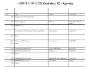
Continental Breakfast. 8:00. Thur. HDF & HDF-EOS Workshop IX - Agenda. Available for 1-1 Consulting ... HDF5 1.8 (cont.) 8:30. Continental Breakfast. 8:00. Fri ...
| PowerPoint PPT presentation | free to download
Global Change Master Directory (GCMD) Mission To assist the scientific community in the discovery of Earth science data, related services, and ancillary ...
| PowerPoint PPT presentation | free to download
Development of a Prototype Web GIS Server for HDF-EOS Data based on OGC Web Map Specifications ... set of new specifications (details later) We are one of the ...
| PowerPoint PPT presentation | free to download
Incorporate additional types of information from Federal and non-Federal sources ... and local agencies, academic institutions, non-governmental organizations, and ...
| PowerPoint PPT presentation | free to view
In developing the SDS, the Project shall assume that EDRs produced by the IDPS ... The CARS will have government oversight and may be physically located anywhere. ...
| PowerPoint PPT presentation | free to view
or with Java-based GUI. Page 5. HEG Functionality. Metadata preservation/creation. ... Download, Documentation, Help: HDFView: http://newsroom.gsfc.nasa.gov/sdptoolkit ...
| PowerPoint PPT presentation | free to download
1 SAIC, contractor to U.S. Geological Survey (USGS) Center for Earth Resources ... Phone and email inquiries (issue resolution) Direct contact (conferences, ...
| PowerPoint PPT presentation | free to download
How does the Earth system respond to natural and human-induced changes? ... Of The Earth System Science Concept Pioneered By NASA Is Essential To ...
| PowerPoint PPT presentation | free to download
... RS6000, SP2 DEC: Alpha/Digital UNIX, OpenVMS VAX: OpenVMS Intel: Solarisx86, Linux, FreeBSD, Windows NT/98 PowerPC: Mac-OS A Sampling of ...
| PowerPoint PPT presentation | free to download


