
Drone Surveying PowerPoint PPT Presentations
All Time
Recommended

Dolphin Engineers are Providing Water Supply Survey, Solar Power Plant Survey, Gas Pipe Line Survey, Petrol Pipe Line Survey in Jaipur.
| PowerPoint PPT presentation | free to download

Let's look at the environmental advantages of drone surveys and how they help to a cleaner future.
| PowerPoint PPT presentation | free to download

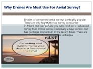
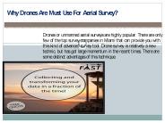
We provide detailed aerial survey and drone survey conducted via drone, surveyors can capture important data—from trees, to building locations, roads, and bodies of water, with much more ease.
| PowerPoint PPT presentation | free to download
Dolphin Engineers are Providing Water Supply Survey, Solar Power Plant Survey, Gas Pipe Line Survey, Petrol Pipe Line Survey in Jaipur.
| PowerPoint PPT presentation | free to download

Bathymetric surveys are an essential part of many marine construction projects. These surveys provide detailed information about the depth and topography of the seafloor, which is crucial for planning and executing various marine engineering projects.
| PowerPoint PPT presentation | free to download

If you looking for drone aerial surveys in the UK. Check out our drone aerial surveys! We provide high-quality drone surveys for photography, promotional videography, house surveys, etc. Get in touch for a free consultation and contact us today at 01283 542257
| PowerPoint PPT presentation | free to download

Vantage Imagery Drone Services is a drone service provider company in Derbyshire, UK. We have provided a drone service who can survey the whole of Derbyshire and provide accurate mapping in 2D or 3D of landscapes or buildings. For more details, visit our website and contact us: 01283 542257.
| PowerPoint PPT presentation | free to download
Drones are often used nowadays in almost all countries for different purposes such as aerial photography, filming, inspections, surveyings, delivery, and security drones to enhance the efficiency of the work. Most drone manufacturers have drones that are built as an end solution for common use, however, whoever needs a customized solution for their drones it might be complex work to modify the existing drone.
| PowerPoint PPT presentation | free to download
My Drone Survey is a collaboration of CAA (PfCO) qualified and fully accredited UAV drone pilots, Asset Managers and Chartered Building Surveyors.
| PowerPoint PPT presentation | free to download

One of the most exciting areas of development for drones is in the field of drone services. Drone services encompass a wide range of applications that leverage the unique capabilities of drones to provide fast, efficient and cost-effective solutions to a variety of challenges.
| PowerPoint PPT presentation | free to download

However, a new horizon has appeared in the form of bathymetric survey drones, which promise to transform the way we explore and map ocean depths.
| PowerPoint PPT presentation | free to download

We'll look at the top five advantages of employing bathymetric drones for coastal and offshore surveys.
| PowerPoint PPT presentation | free to download

Building surveying is changing a lot because of drone technology. We will talk about what that means for the business.
| PowerPoint PPT presentation | free to download

There are many methods available to map the Earth around us. The old techniques and the latest techniques have vast differences. A topographic survey using drones is the latest technique that is used for various purposes. For more Information about topographical surveys using drones visit Falcon 3D.
| PowerPoint PPT presentation | free to download

Enter underwater drone mapping surveys, a revolutionary instrument that allows us to record and analyze underwater habitats in unprecedented depth.
| PowerPoint PPT presentation | free to download

Let's look at how this breakthrough technology is transforming the area of land surveying.
| PowerPoint PPT presentation | free to download
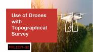
There are many methods available to map the Earth around us. The old techniques and the latest techniques have vast differences. A topographic survey using drones is the latest technique that is used for various purposes. For more Information about topographical surveys using drones visit Falcon 3D.
| PowerPoint PPT presentation | free to download

We offer licensed surveys include 3D tampa mapping, aggregate & stockpile volume measurement in Miami, East & West Coast at Florida Aerial Survey Technologies
| PowerPoint PPT presentation | free to download

Solar Power Plant Surveys Solar Power industry in India is gaining more and more importance every day as the other natural resources are growing expensive. The domestic/off-grid industry is picking up speed too. People are installing solar panels so as to utilize the free resource for their daily needs.
| PowerPoint PPT presentation | free to download

Aerial Inspection Services, Drone Inspection Services, Hire A Drone Pilot, Aerial Filming Dubai, Aerial Surveying Uae, Drones for Agriculture
| PowerPoint PPT presentation | free to download

Drone mapping services have transformed the landscape of surveying and mapping, offering unparalleled precision, efficiency, and cost-effectiveness. As these technologies continue to advance, we can expect even more accurate data collection, faster processing times, and expanded applications.
| PowerPoint PPT presentation | free to download

Technology has transformed the world tremendously. Drones are widely used for inspections and inspections. Several industries use visual drone inspection. These include the agriculture industry, chemical industry, construction projects, power generation industry, public safety, and much more. For UAE drone experts, contact Falcon 3D Middle East today.
| PowerPoint PPT presentation | free to download
We offer licensed surveys include 3D tampa mapping, aggregate & stockpile volume measurement in Miami, East & West Coast at Florida Aerial Survey Technologies
| PowerPoint PPT presentation | free to download
Accurate surveying & professional land mapping services include topographical mapping, contour mapping progress mapping, volume calculation and elevation mapping.
| PowerPoint PPT presentation | free to download

This report focuses on Photography Drone volume and value at global level, regional level and company level. From a global perspective, this report represents overall Photography Drone market size by analyzing historical data and future prospect.
| PowerPoint PPT presentation | free to download

This report studies VTOL Drones in Global market, especially in North America, China, Europe, Southeast Asia, Japan and India, with production, revenue, consumption, import and export in these regions, from 2013 to 2018, and forecast to 2025.
| PowerPoint PPT presentation | free to download

The future of professional land surveying is rapidly shifting as a result of exponentially rising technological advancements. With the correct land surveying equipment, the future of land surveying is bright. Read here how land surveying is changing.
| PowerPoint PPT presentation | free to download

Drones have been a hot topic in recent years and their popularity only seems to be growing. Whether it’s for capturing stunning aerial footage or for delivering packages, drones are being used in a variety of industries.
| PowerPoint PPT presentation | free to download

Arvista provides high-quality UAV aerial surveying services, Mine and engineering surveying services in Australia to the mining and construction industries. We are based in Perth, Western Australia and can provide services throughout Australia and also internationally.
| PowerPoint PPT presentation | free to download

This Report provided by 24 Market Reports is about, Photography Drones in Global market, especially in North America, China, Europe, Southeast Asia, Japan and India, with production, revenue, consumption, import and export in these regions, from 2012 to 2016, and forecast to 2022.
| PowerPoint PPT presentation | free to download

Looking for service provider who can provide quality Drone Photography, Filming and survey services in India. Here is Aerialphoto.in which is the best Drone Photography, Filming and survey services in India. For Inquiry visit:
| PowerPoint PPT presentation | free to download

Tackle criminals effectively, and respond to exigencies quickly with the cutting-edge drone of Freefly Alta X supplied by Air-Supply at cost-effective prices.
| PowerPoint PPT presentation | free to download
In the event that you're looking for quality Elevated Shooting and Photography administrations, at that point look no more remote than our Authorized UAV Pilots using our first class cameras.
| PowerPoint PPT presentation | free to download
Aerial Inspections Using Drone-UAV in UAE: Falcon3dme’s small drones service are capable to reach places that are difficult, expensive, dangerous, live or even impossible to approach by manned inspection teams.
| PowerPoint PPT presentation | free to download

This new technology is changing the way construction businesses approach surveying, site analysis, and project management. aerial drone mapping Know More: https://www.falconsurveyme.com/our-services/aerial-mapping/
| PowerPoint PPT presentation | free to download

Drone technology offers several applications in governance, contributing to various aspects of public administration and governance processes.
| PowerPoint PPT presentation | free to download

Many drone manufacturers have their own drone models that suit specific tasks, either filming, delivery, surveying, or security. However, the customization of drones for specific requirements is quite a hard task. In order to cater to these drone customization tasks, the Customized Drones™ team has introduced their research and development lab with advanced AI technology.
| PowerPoint PPT presentation | free to download

Unlike traditional methods of mapping and surveying, drone mapping involves aerial mapping technology. Drone mapping entails using advanced drones to survey an area and gather numerous data. It collects detailed data that are greater in efficiency, accuracy, and safety compared to traditional mapping procedures. It speeds up the process and saves considerable time. It also reduces costs and maximises return on investment.Read more :-https://www.agridronespecialists.co.nz/drone-mapping/
| PowerPoint PPT presentation | free to download

Commercial Drone Market by Point of Sale (OEM, Aftermarket), Systems (Platform, Payload, Datalink, Ground Control Station, Launch & Recovery Systems), Platform (Micro, Small, Medium, Large), Function (Passenger Drones, Inspection & Monitoring Drones, Surveying & Mapping Drones, Spraying & Seeding Drones, Cargo Air Vehicles, Others)
| PowerPoint PPT presentation | free to download
C-Drones provide custom-built drone solutions for Aerial Mapping/ Surveying in South Africa to reduce field time and survey costs, provide accurate and exhaustive data, map otherwise inaccessible area, Capture High-resolution Images &cover large areas quickly from different angles, and much more. Learn more: https://c-drones.com/za/aerial-surveying-and-mapping-drones-africa/ Contact us at: info@c-drones.com
| PowerPoint PPT presentation | free to download

Help for further studies
| PowerPoint PPT presentation | free to download

Choosing the right land surveying drone is the top challenge you might face. Consider these things to look for when buying a drone for land surveying. Contact Falcon 3D, if you are looking for ways to survey your land with a drone and for a drone topographic survey.
Voler Drones is a specialist drone surveying and inspection company with years of experience as a drone operator, serving professionals and homeowners. We are CAA certified commercial drone pilots, who are required to operate drones safely and our pilots hold commercial drone pilot training. We operate in Scotland, namely Glasgow, Edinburgh, Perth and Aberdeen.
| PowerPoint PPT presentation | free to download
C-Drones provide custom-built drone solutions for Aerial Mapping/ Surveying in Canada to reduce field time and survey costs, provide accurate and exhaustive data, map otherwise inaccessible area , Capture High-resolution Images &cover large areas quickly from different angles and much more. Learn more: https://c-drones.com/ca/aerial-surveying-and-mapping-drones/
| PowerPoint PPT presentation | free to download
Mapping drones have become a major discussion topic in various countries, with a particular focus on South Africa. They play a pivotal role in the mapping and surveying industry. To further elevate the performance of mapping drones, the renowned drone manufacturer, Customized Drones™ based in the UAE, has recently announced their advanced mapping drones equipped with AI capabilities.
| PowerPoint PPT presentation | free to download

Mapping drones are most trending in South Africa, as they are being used to survey and monitor various areas such as wildlife reserves, agricultural lands, and infrastructure projects. As a key drone manufacturer in the region, the Customized Drones™ team is constantly innovating and developing new technologies to meet the growing demand for advanced mapping drones in South Africa.
| PowerPoint PPT presentation | free to download

C-Drones is a Specialist Drones/UAV company for R&D of industrial and commercial applications of drones. We provide custom-built drone solutions for specific industrial/ scientific applications like crop spraying, medical/food delivery, and UAV Aerial Surveying in Australia. For more visit : https://c-drones.com/au/medical-food-delivery-drone/
| PowerPoint PPT presentation | free to download
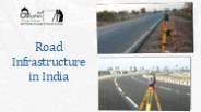
After Having Exhaustive & distinguished Experience in Different Disciplines of topographic survey, wind energy plant survey, DGPS survey, water supply and gas pipe line survey, contour survey, national highway survey, bridge details survey, lay out marking survey, solar power plant survey etc. Our Organization Named "Dolphin Engineer" was established 1999. Aim of Organization is to Provide Quality Services with in the specified time using Highly Skilled, Qualified & Experienced Manpower in Infrastructure & other development Project in Civil Engineering, to the entire Satisfaction of the Client.
| PowerPoint PPT presentation | free to download
C-Drones provide custom-built drone solutions for Aerial Mapping/ Surveying in Saudi Arabia to reduce field time and survey costs, provide accurate and exhaustive data, map otherwise inaccessible area, Capture High-resolution Images &cover large areas quickly from different angles, and much more. Learn more: Learn more: Contact us at: info@c-drones.com
| PowerPoint PPT presentation | free to download
Customized Drones™, a leading drone manufacturer based in Dubai, has planned to introduce advanced AI-powered mapping drones in Saudi Arabia. This initiative is poised to revolutionize the surveying and mapping processes within the country.
| PowerPoint PPT presentation | free to download
Drone inspection offers considerable economic and human safety advantages. Drone inspection not only reduces heavy costs related to constructing traditional access methods, but also nearly offsets the risks of manned labor working at night. At present, drone inspection is the preferred method for visual surveys across a wide range of industries.
| PowerPoint PPT presentation | free to download

The quickest and most cost efficient solution for site surveys is the modern UAV drone, compared to more expensive traditional methods of scaffolding or platforms.
| PowerPoint PPT presentation | free to download

Introducing mapping drones is currently a prominent trend worldwide, particularly in countries like Saudi Arabia, known for its extensive geographical expanses that demand significant time for surveying tasks. Customized Drones™, a leading drone manufacturer based in Dubai, is gearing up to introduce their latest advanced mapping drone to the Saudi Arabian market, featuring advanced customizations.
| PowerPoint PPT presentation | free to download

Mapping drones have become a major discussion topic in various countries, with a particular focus on Saudi Arabia (KSA). They play a pivotal role in the mapping and surveying industry. To further elevate the performance of mapping drones, the renowned drone manufacturer, Customized Drones™ based in the UAE, has recently announced their advanced mapping drones equipped with AI capabilities.
| PowerPoint PPT presentation | free to download

Providing Surveillance with Drone Security Pinnacle Protection provides drone security services that allow security personnel to identify and deter threats, survey larger areas in less time, and respond more effectively to intruders. Aerial drone services are an ideal tool for upgrading your security presence. They are able to traverse a route more quickly and effectively than a person, moving over obstructions easily and being able to view rooftops. Drone aircraft can penetrate through small and confined spaces, they make minimal noise and can be fitted with night-vision cameras and thermal sensors to provide high definition vision that can not be seen by the human eye.
| PowerPoint PPT presentation | free to download

Reduced drone inspection cost and better surveys With Falcon 3D Middle East today. We offer cost-effective drone inspection services including aerial mapping and survey accuracy, solar panel drone inspection, mining, quarries & aggregates of critical areas on onshore and offshore constructions.
| PowerPoint PPT presentation | free to download