Drone Mapping Survey PowerPoint PPT Presentations
All Time
Recommended
Let's look at the environmental advantages of drone surveys and how they help to a cleaner future.
| free to download
Enter underwater drone mapping surveys, a revolutionary instrument that allows us to record and analyze underwater habitats in unprecedented depth.
| free to download
One of the most exciting areas of development for drones is in the field of drone services. Drone services encompass a wide range of applications that leverage the unique capabilities of drones to provide fast, efficient and cost-effective solutions to a variety of challenges.
| free to download
Drone mapping services have transformed the landscape of surveying and mapping, offering unparalleled precision, efficiency, and cost-effectiveness. As these technologies continue to advance, we can expect even more accurate data collection, faster processing times, and expanded applications.
| free to download
Bathymetric surveys are an essential part of many marine construction projects. These surveys provide detailed information about the depth and topography of the seafloor, which is crucial for planning and executing various marine engineering projects.
| free to download
Vantage Imagery Drone Services is a drone service provider company in Derbyshire, UK. We have provided a drone service who can survey the whole of Derbyshire and provide accurate mapping in 2D or 3D of landscapes or buildings. For more details, visit our website and contact us: 01283 542257.
| free to download
If you looking for drone aerial surveys in the UK. Check out our drone aerial surveys! We provide high-quality drone surveys for photography, promotional videography, house surveys, etc. Get in touch for a free consultation and contact us today at 01283 542257
| free to download
C-Drones provide custom-built drone solutions for Aerial Mapping/ Surveying in South Africa to reduce field time and survey costs, provide accurate and exhaustive data, map otherwise inaccessible area, Capture High-resolution Images &cover large areas quickly from different angles, and much more. Learn more: https://c-drones.com/za/aerial-surveying-and-mapping-drones-africa/ Contact us at: info@c-drones.com
| free to download
Drones are often used nowadays in almost all countries for different purposes such as aerial photography, filming, inspections, surveyings, delivery, and security drones to enhance the efficiency of the work. Most drone manufacturers have drones that are built as an end solution for common use, however, whoever needs a customized solution for their drones it might be complex work to modify the existing drone.
| free to download
This new technology is changing the way construction businesses approach surveying, site analysis, and project management. aerial drone mapping Know More: https://www.falconsurveyme.com/our-services/aerial-mapping/
| free to download
Unlike traditional methods of mapping and surveying, drone mapping involves aerial mapping technology. Drone mapping entails using advanced drones to survey an area and gather numerous data. It collects detailed data that are greater in efficiency, accuracy, and safety compared to traditional mapping procedures. It speeds up the process and saves considerable time. It also reduces costs and maximises return on investment.Read more :-https://www.agridronespecialists.co.nz/drone-mapping/
| free to download
C-Drones provide custom-built drone solutions for Aerial Mapping/ Surveying in Canada to reduce field time and survey costs, provide accurate and exhaustive data, map otherwise inaccessible area , Capture High-resolution Images &cover large areas quickly from different angles and much more. Learn more: https://c-drones.com/ca/aerial-surveying-and-mapping-drones/
| free to download
Mapping drones are most trending in South Africa, as they are being used to survey and monitor various areas such as wildlife reserves, agricultural lands, and infrastructure projects. As a key drone manufacturer in the region, the Customized Drones™ team is constantly innovating and developing new technologies to meet the growing demand for advanced mapping drones in South Africa.
| free to download
C-Drones provide custom-built drone solutions for Aerial Mapping/ Surveying in Saudi Arabia to reduce field time and survey costs, provide accurate and exhaustive data, map otherwise inaccessible area, Capture High-resolution Images &cover large areas quickly from different angles, and much more. Learn more: Learn more: Contact us at: info@c-drones.com
| free to download
In the realm of agriculture, large-scale farming poses unique challenges. Managing extensive tracts of land, monitoring crops, and optimizing resources is no small feat. Enter drone mapping services—a groundbreaking technology reshaping large-scale farming. Here’s how drones are revolutionising the industry. Read more :-https://www.agridronespecialists.co.nz/drone-mapping/
| free to download
Mapping Drones have become more and more common for those working in archeology and architecture professions, as it is a great source of efficiency for topographic survey. The topographic survey includes accurately mapping with the help of a drone/UAV the natural and man-made features of a particular piece of land. The goal is to represent the three-dimensional features of the terrain in a two-dimensional format, typically in the form of a topographic map.
| free to download
However, a new horizon has appeared in the form of bathymetric survey drones, which promise to transform the way we explore and map ocean depths.
| free to download
Mapping drones have become a major discussion topic in various countries, with a particular focus on South Africa. They play a pivotal role in the mapping and surveying industry. To further elevate the performance of mapping drones, the renowned drone manufacturer, Customized Drones™ based in the UAE, has recently announced their advanced mapping drones equipped with AI capabilities.
| free to download
The final product of drone mapping or aerial surveying in construction is a map. The two most prevalent ways of mapping with drones are photogrammetry and laser ranging (LiDAR). Using either way, you'll get a different kind of map and you'll need specialised tools to analyse the data.
| free to download
There are many methods available to map the Earth around us. The old techniques and the latest techniques have vast differences. A topographic survey using drones is the latest technique that is used for various purposes. For more Information about topographical surveys using drones visit Falcon 3D.
| free to download
In this guide, we'll look at what bathymetric lidar drones are, how they work, and their importance in unearthing the secrets of the underwater environment.
| free to download
We'll look at the top five advantages of employing bathymetric drones for coastal and offshore surveys.
| free to download
Saudi Arabia is a country having vast and diverse landscapes, with this environmental situation, the Customized Drones™ team in Dubai, which is a leading drone manufacturer in Dubai, introduces their advanced mapping drone with high-end customized features that give many benefits for many industries in Saudi Arabia.
| free to download
Customized Drones™, a leading drone manufacturer based in Dubai, has planned to introduce advanced AI-powered mapping drones in Saudi Arabia. This initiative is poised to revolutionize the surveying and mapping processes within the country.
| free to download
Mapping drones in Saudi Arabia are becoming increasingly popular in the region, as they offer a number of advantages over traditional surveying methods. Drones can collect data quickly and efficiently, and they can access areas that would be difficult or dangerous for humans to reach. This makes them ideal for a variety of applications.
| free to download
Introducing mapping drones is currently a prominent trend worldwide, particularly in countries like Saudi Arabia, known for its extensive geographical expanses that demand significant time for surveying tasks. Customized Drones™, a leading drone manufacturer based in Dubai, is gearing up to introduce their latest advanced mapping drone to the Saudi Arabian market, featuring advanced customizations.
| free to download
Mapping drones have become a major discussion topic in various countries, with a particular focus on Saudi Arabia (KSA). They play a pivotal role in the mapping and surveying industry. To further elevate the performance of mapping drones, the renowned drone manufacturer, Customized Drones™ based in the UAE, has recently announced their advanced mapping drones equipped with AI capabilities.
| free to download
There are many methods available to map the Earth around us. The old techniques and the latest techniques have vast differences. A topographic survey using drones is the latest technique that is used for various purposes. For more Information about topographical surveys using drones visit Falcon 3D.
| free to download
Before a construction project starts, land surveying includes taking measurements of a particular piece of land. Before crews break ground, much planning & design are included. Drone mapping services are very popular nowadays. Time and costs can be decreased, inaccessible maps areas can be covered, fewer disruptions; more accurate data can be measured. The above information will provide a detailed overview of its benefits.
| free to download
Aerial Inspection Services, Drone Inspection Services, Hire A Drone Pilot, Aerial Filming Dubai, Aerial Surveying Uae, Drones for Agriculture
| free to download
Technology has transformed the world tremendously. Drones are widely used for inspections and inspections. Several industries use visual drone inspection. These include the agriculture industry, chemical industry, construction projects, power generation industry, public safety, and much more. For UAE drone experts, contact Falcon 3D Middle East today.
| free to download
We offer licensed surveys include 3D tampa mapping, aggregate & stockpile volume measurement in Miami, East & West Coast at Florida Aerial Survey Technologies
| free to download
Accurate surveying & professional land mapping services include topographical mapping, contour mapping progress mapping, volume calculation and elevation mapping.
| free to download
Looking for service provider who can provide quality Drone Photography, Filming and survey services in India. Here is Aerialphoto.in which is the best Drone Photography, Filming and survey services in India. For Inquiry visit:
| free to download
Tackle criminals effectively, and respond to exigencies quickly with the cutting-edge drone of Freefly Alta X supplied by Air-Supply at cost-effective prices.
| free to download
In the event that you're looking for quality Elevated Shooting and Photography administrations, at that point look no more remote than our Authorized UAV Pilots using our first class cameras.
| free to download
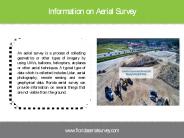
Aerial mapping drones have a variety of applications in the mapping and land surveying industries. They are used to assist surveyors in quickly, easily, and affordably mapping big areas. The purpose of deploying drones is to improve processes and minimize time-consuming manual mapping and surveying. For more information about our Aerial mapping services please visit: https://www.falcon3dme.com/drone-inspection-services.html
| free to download
Aerial Inspections Using Drone-UAV in UAE: Falcon3dme’s small drones service are capable to reach places that are difficult, expensive, dangerous, live or even impossible to approach by manned inspection teams.
| free to download
Your project's productivity and effectiveness can be drastically improved by using Drones. They aid in lessening project costs by enabling more effortless access and capturing amounts of extremely accurate data in a shorter time and diminishing risks by providing detailed monitoring of rough regions, secluded sites, and not so easy-to-reach structures.
| free to download
The LiDAR drone market is projected to grow from USD 133 million in 2020 to USD 392 million by 2025; it is expected to grow at a CAGR of 24.2% from 2020 to 2025. Key factors fueling the growth of this market include easing of regulations related to the use of commercial drones in different applications and growing demand for LiDAR drones for use in corridor mapping and precision agriculture applications.
| free to download
The LiDAR drone market is projected to grow from USD 133 million in 2020 to USD 392 million by 2025; it is expected to grow at a CAGR of 24.2% from 2020 to 2025
| free to download
Reduced drone inspection cost and better surveys With Falcon 3D Middle East today. We offer cost-effective drone inspection services including aerial mapping and survey accuracy, solar panel drone inspection, mining, quarries & aggregates of critical areas on onshore and offshore constructions.
| free to download
As the leading services for LiDAR mapping in India, our team specializes in LiDAR surveys, digital orthophotography, and photogrammetry services. We have the work force, hardware, and ability to give quick reaction to your basic review, photography, and mapping needs, paying little mind to where your undertaking is found. For more information visit us at- http://www.yolaxinfra.com/drone-lidar-survey.php
| free to download
The drone is used in different places. With aerial filming and photography, you can make your marketing better. The drone is also used in different types of project such as land mapping. With the help of the drone, you can survey the land and take clear pictures of the different places.
| free to download
The agriculture drones market is at its growth phase; it is expected to reach USD 4,209.2 million by 2022, growing at a CAGR of 30.19%. Rise in the awareness about the benefits of agriculture drones among the farmers and agronomists and the availability of software solutions for field surveys and data analytics are the key factors driving the growth of this market. “Field mapping application is expected to capture the largest share of the agriculture drones market during the forecast period”
| free to download
Inspectifly LLC specializes in UAV / Drone based Inspection services, Aerial Survey, Photography, Mapping, Aerial Thermal Inspection and Drone Services. Contact Us Now!
| free to download
Inspectifly LLC specializes in UAV / Drone based Inspection services, Aerial Survey, Photography, Mapping, Aerial Thermal Inspection and Drone Services. Contact Us Now!
| free to download
Commercial Drone Market by Point of Sale (OEM, Aftermarket), Systems (Platform, Payload, Datalink, Ground Control Station, Launch & Recovery Systems), Platform (Micro, Small, Medium, Large), Function (Passenger Drones, Inspection & Monitoring Drones, Surveying & Mapping Drones, Spraying & Seeding Drones, Cargo Air Vehicles, Others)
| free to download
Dolphin Engineer offers precise mine survey services tailored to ensure efficient mining operations. Utilizing advanced equipment and software, our skilled team provides accurate measurements and layouts for resource mapping, safety planning, and project execution. Our services ensure compliance with mining regulations and help optimize resources, ensuring sustainability and operational excellence in your mining projects.
| free to download
For more details: https://thedroningcompany.com/job-list
| free to download
We offer licensed surveys include 3D tampa mapping, aggregate & stockpile volume measurement in Miami, East & West Coast at Florida Aerial Survey Technologies
| free to download
We offer licensed surveys include 3D tampa mapping, aggregate & stockpile volume measurement in Miami, East & West Coast at Florida Aerial Survey Technologies
| free to download
Bathymetric survey drones, also known as underwater drones, are becoming an increasingly popular tool for conducting surveys of the ocean floor. These drones come in a variety of different types, each with their own unique features and capabilities.
| free to download
For more information kindly visit : https://www.bharatbook.com/consumer-electronics-market-research-reports-764856/agriculture-drones-type-application-component-geography-global-forecast.html Bharat Book Bureau provides the report, on “ Agriculture Drones Market by Type Application, Component and Geography - Global Forecast to 2022 ”. Field mapping application captured the largest share of the agriculture drones market in 2015 and is expected to exhibit the same trend till 2022.
| free to download


